
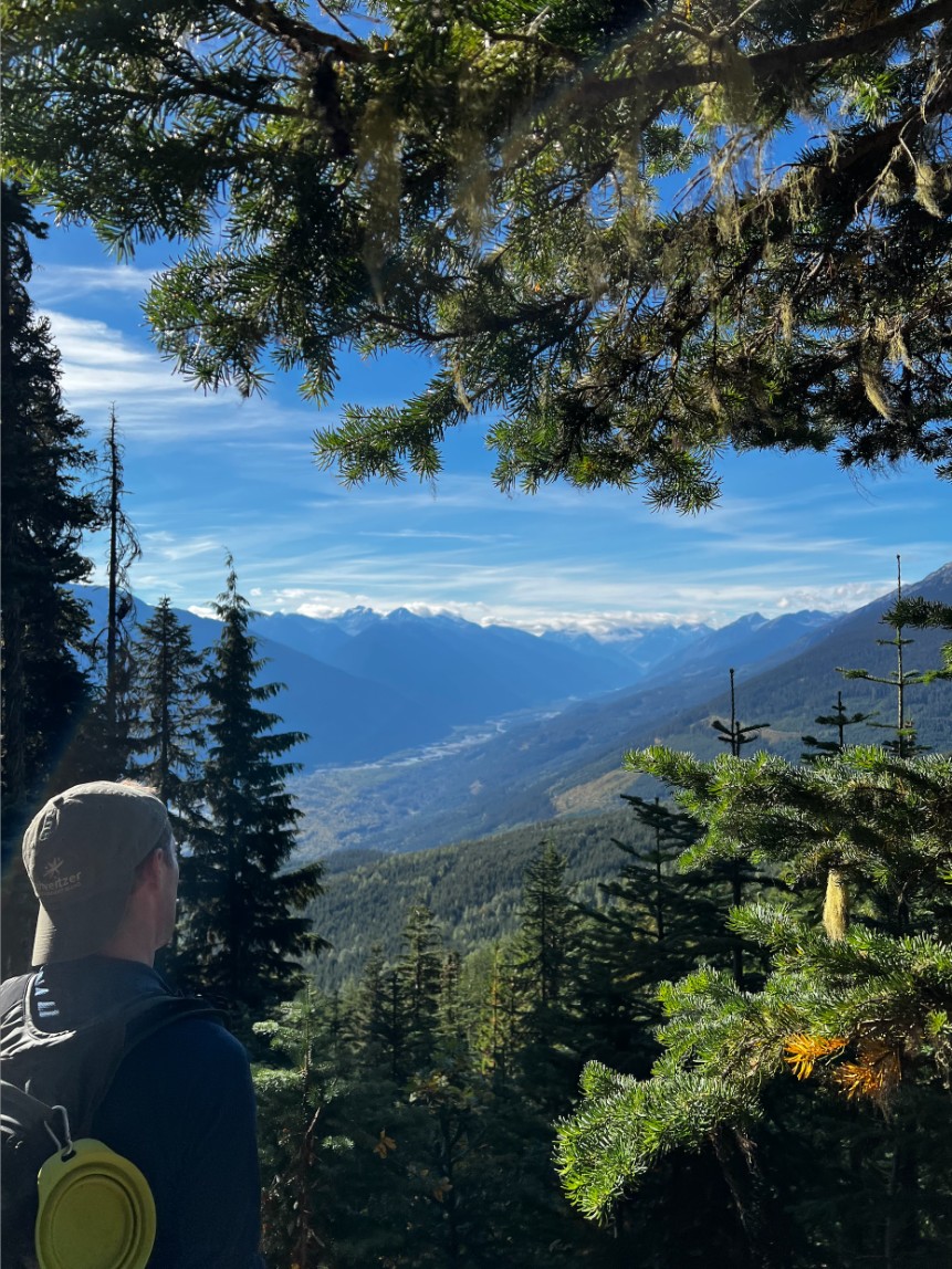
Situated just two hours outside of Vancouver, Canada, Pemberton, British Columbia is a nature lovers’ paradise. With towering mountains, cascading waterfalls, and thriving farms, there’s just so much beautiful nature to see in this little town. And the best way to see it all is by hiking in Pemberton.
As always, when hiking, please take precautions to be safe! Research the trails thoroughly beforehand, go with a buddy, check out the weather forecast, and pack all the gear you need. Stay safe, everyone!
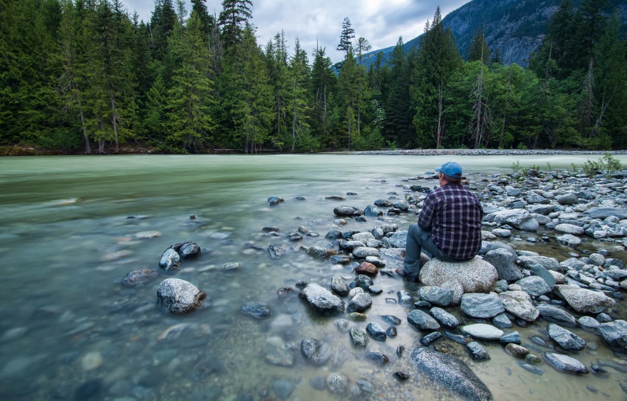
Nairn Falls Trail
By far the most popular hike in Pemberton is the Nairn Falls Trail. Located within Nairn Falls Provincial Park, this trail is one you definitely won’t want to miss out on.
Starting just off the Sea-to-Sky Highway, the three-kilometre path to the falls is very easy to follow. You’ll hike along the flowing Green River and under the towering evergreen trees, until you eventually reach the beautiful 36-metre cascade known as Nairn Falls.
Elevation gain: 108 m (354 ft)
One-way distance: 1.3 km (0.8 mi)
Roundtrip distance: 2.6 km (1.6 mi)
Estimated time: 1 hour
Getting there:
Simply navigate yourself to Nairn Falls Provincial Park.
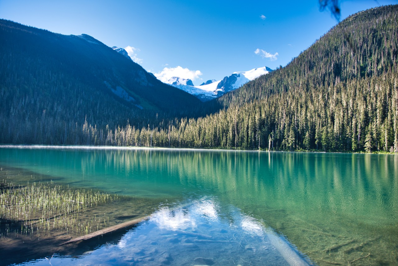
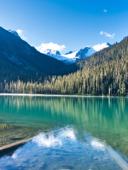
Joffre Lakes Trail
The Joffre Lakes Trail is the highlight of Pemberton’s Joffre Lakes Provincial Park. As you hike your way along the 9.4-kilometre trail, there’s so much to see. Thriving evergreen trees, snowy mountains, and cascading waterfalls are just the beginning. As a matter of fact, most people tackle this hike to see the three famed lakes, appropriately named Lower Joffre Lake, Middle Joffre Lake, and Upper Joffre Lake.
While the Joffre Lakes Trail is most popular in the summer, it still attracts quite a crowd in the winter months as well. After snowshoeing your way to each of the lakes, you’ll find them frozen solid – making them the perfect place for a few winter activities. Odds are, you’ll get to see some fellow hikers playing ice hockey, doing a little ice skating, or simply having a picturesque snowy picnic.
*Note: If you plan on parking at Joffre Lakes Provincial Park, be sure to reserve a free Day Use Pass in advance.
Elevation gain: 491 m (1,610 ft)
One-way distance: 3.7 km (2.3 mi)
Roundtrip distance: 7.4 km (4.6 mi)
Estimated time: 3 hours
Getting there:
Route yourself to “Joffre Lakes Provincial Park.” Once you park in the designated parking lot, the trailhead should be visible.
Tenquille Lake Hike
While the three Joffre lakes are the most famous ones in Pemberton, they’re definitely not the only lakes that are worthwhile. The Tenquille Lake Trail is home to the equally beautiful Tenquille Lake. With its picturesque waters, it’s the perfect place to fish, picnic, and even kayak – but first you have to get there.
The Tenquille Lake Trail is definitely one of the more advanced hikes in Pemberton. At 12 kilometres long and 500 metres of elevation gain, you’ll need to set aside practically a full day. But along the way, there’s so much to see that the day will just zip past! Blooming wildflowers, picture-perfect mountains, towering trees, sparkling lakes – what more could you ask for from a day in nature?
If you want to stick around on this trail a little longer, you certainly can! Quite a few hikers decide to take their time on this trail and camp for the night, making it a two-day trek. If you get extra lucky, there’s even an adorable little cabin you can snag, if no one else has claimed it yet.
Elevation gain: 500 m (1,640 ft)
One-way distance: 6 km (3.7 mi)
Roundtrip distance: 12 km (7.5 mi)
Estimated time: 6 hours
Getting there:
Navigate yourself to the “Tenquille Lake Trailhead.”
Pemberton Creek Falls Trail
When learning about hiking in Pemberton, there’s a very good chance that Pemberton Creek Falls Trail won’t come up. As a matter of fact, this under-the-radar hike is often called “the waterfall that no one knows about.”
To find the start of this hidden trail, you’ll want to make your way to Eagle Ridge Drive. From there, you’ll come across a couple of different route options to start. But regardless of the initial path you take, you’ll eventually find a set of small buildings and the path will become a little more clear. And at the end of a one-kilometre (one-way) journey, you’ll be amazed by the secret 61-metre cascade known as Pemberton Creek Falls.
Elevation gain: 35 m (115 ft)
One-way distance: 1 km (0.6 mi)
Roundtrip distance: 2 km (1.2 mi)
Estimated time: 1 hour and 15 minutes
Getting there:
Route yourself to Eagle Ridge Drive. From there, the trail options should be relatively visible.
Mount Currie Trail
From just about everywhere in Pemberton, you can see the beautiful snow-capped Mount Currie. And one of the best hikes in this Canadian town takes you all the way to the top.
As you probably expect, the Mount Currie trail is quite a workout – and it’ll take you pretty much the whole day. After all, it’s 2,591 metres tall. But luckily for you, you won’t have to start all the way at the base of the mountain. You’ll get a couple hundred metres of a boost, so you’ll only have to tackle 2,350 metres of elevation. (Obviously, we’re being sarcastic, but a little boost is better than no boost, right?)
You’ll come across all sorts of terrains on this Pemberton hike – from creeks to boulders to meadows. And at the end of it all, you’ll be greeted with a magical view of the surrounding snow-capped peaks of the Cayoosh Mountain Range.
Since the trek up Mount Currie can be very strenuous, you may want to consider spreading the journey into a two-day hike. Luckily, there’s a campground partway through, just for that purpose!
*Note: We want to emphasize that the Mount Currie Trail is not an easy hike. Instead, it’s a very difficult one. Please don’t attempt this hike unless you’re adequately prepared – both in terms of skills and gear.
Elevation gain: 2,350 m (7,706 ft)
One-way distance: 10.1 km (6.3 mi)
Roundtrip distance: 20.2 km (12.6 mi)
Estimated time: 12 hours
Getting there:
Getting to the Mount Currie trailhead can be quite tricky as well. From Pemberton, you’ll want to head South on the Sea-to-Sky Highway until you see the dirt road at the Green River Motocross Track. Turn in there.
If you have a 2WD, you’ll want to park on this road and add another 30 minutes of hiking to your plans. If you have a 4WD, you can continue on a little further until you reach the official trailhead.
Pemberton Valley Loop
The Pemberton Valley Loop Trail is quite different from the rest of the hikes in Pemberton. Rather than hiking up mountains or along rivers, this easy, 7.9 kilometre hike is more of a scenic stroll through Pemberton’s farm country. Along the way, you can pick up fresh fruits and veggies from farm stands, say hello to friendly horses, and potentially even grab a farm fresh bite to eat!
Of course, that’s not to say that there aren’t jaw-dropping views to enjoy along the way – because there certainly are! The Pemberton Valley Loop Trail also boasts amazing views of the flowing Lillooet River and snow-topped Mount Currie.
Elevation gain: 36 m (118 ft)
Distance (same for one-way and roundtrip, since it is a loop trail): 7.9 km (4.9 mi)
Estimated time: 1 hour and 30 minutes
Getting there:
Since it is a loop, you can technically start anywhere on the Pemberton Valley Loop Trail. But for parking purposes, it may be easiest to park somewhere in “downtown” Pemberton and go from there. Or if you happen to be staying close to the small town centre, you can simply leave your car at your accommodation and walk to the trail instead.
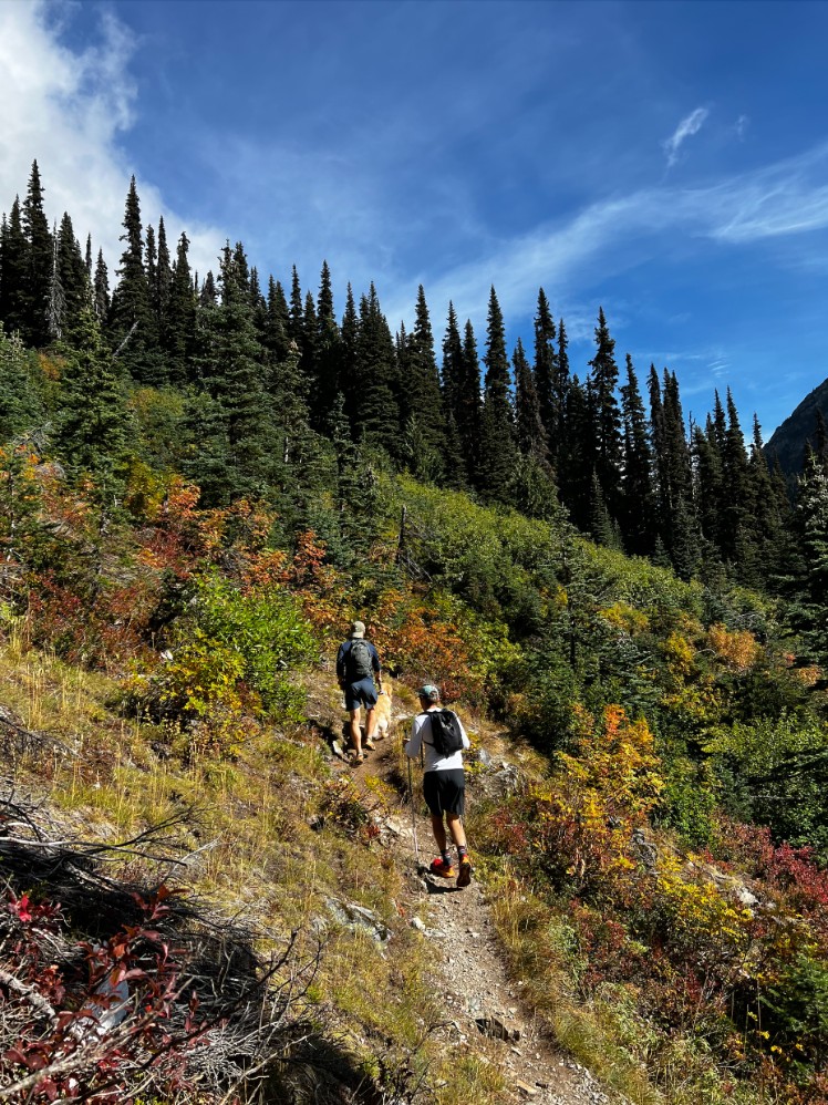
Mount Rohr Hike
Last but certainly not least, we have the Mount Rohr Hike. Like the Tenquille Lake Hike and the Mount Currie Trail, the Mount Rohr Hike isn’t for the average hiker. With 7.6 kilometres to hike and 1,151 metres of elevation gain to tackle, it’s no easy feat.
But if you’re ready and able to take on the challenge, the effort of the Mount Rohr Hike is totally worth the reward. The Mount Rohr Hike starts on the same path as another fantastic Pemberton hike, the Marriot Basin Trail. Eventually, the path forks, and you just have to follow the appropriate sign to continue your greenery-filled adventure. At the end, you’ll get to take in incredible views of mountain peaks and lakes galore – including the three lakes from the Joffre Lakes Trail trail!
As with many of the longer hikes in Pemberton, you can opt to turn this day hike into an overnight hike. Find one of the camping spots along the trail or snag the beloved Wendy Thompson hut for yourself.
Elevation gain: 1,151 m (3,766 ft)
One-way distance: 7.6 km (4.7 mi)
Roundtrip distance: 15.9 km (9.9 mi)
Estimated time: 7 hours
Getting there:
Using Google Maps (as the same destination isn’t available on Apple Maps), route yourself to “Sand Shed Parking for Wendy Thompson Hut.” If you have a 2WD, this is where you can park and begin your adventure! And if you have a 4WD, you can keep driving along the dirt path for another 2.5 kilometres or so, until you reach a second parking area and the trailhead.
And there you have it! Where to go hiking in Pemberton, British Columbia! If you have any questions, feel free to leave them in the comments below.
Worked up an appetite after your hike? Check out our guide to the best restaurants in Pemberton! Looking for more to do while visiting? Read our post on the best things to do in Pemberton!
20bet
Tuesday 12th of September 2023
Your article gave me a lot of inspiration, I hope you can explain your point of view in more detail, because I have some doubts, thank you.
Sign Up
Wednesday 24th of May 2023
The point of view of your article has taught me a lot, and I already know how to improve the paper on gate.oi, thank you. https://www.gate.io/vi/signup/XwNAU
indicac~ao binance
Friday 28th of April 2023
I don't think the title of your article matches the content lol. Just kidding, mainly because I had some doubts after reading the article. https://accounts.binance.com/pt-PT/register?ref=RQUR4BEO
gate io
Thursday 9th of February 2023
Your article helped me a lot, thanks for the information. I also like your blog theme, can you tell me how you did it?