
A Classic Ski Tour: The Haute Route
In the world of ultimate ski trips, there is one that is often at the top of every adventure skier’s bucket list – The Haute Route. Meaning “High Road” in English, The Haute Route traverses the French and Swiss Alps from Chamonix, France to Zermatt, Switzerland. As we head into Spring ski season, I can’t help but reflect on our Haute Route trip in 2017 with a group of very experienced ski friends and two professional guides (highly recommended for this trip). During the seven-day trip, our group set out to conquer the Haute Route while crossing glaciers and high mountain passes using mountaineering equipment and touring skis.
For a preview of the trip, check out the trailer video below. The full video of the trip is long but well worth the time as it’s a documentary of our entire trip.
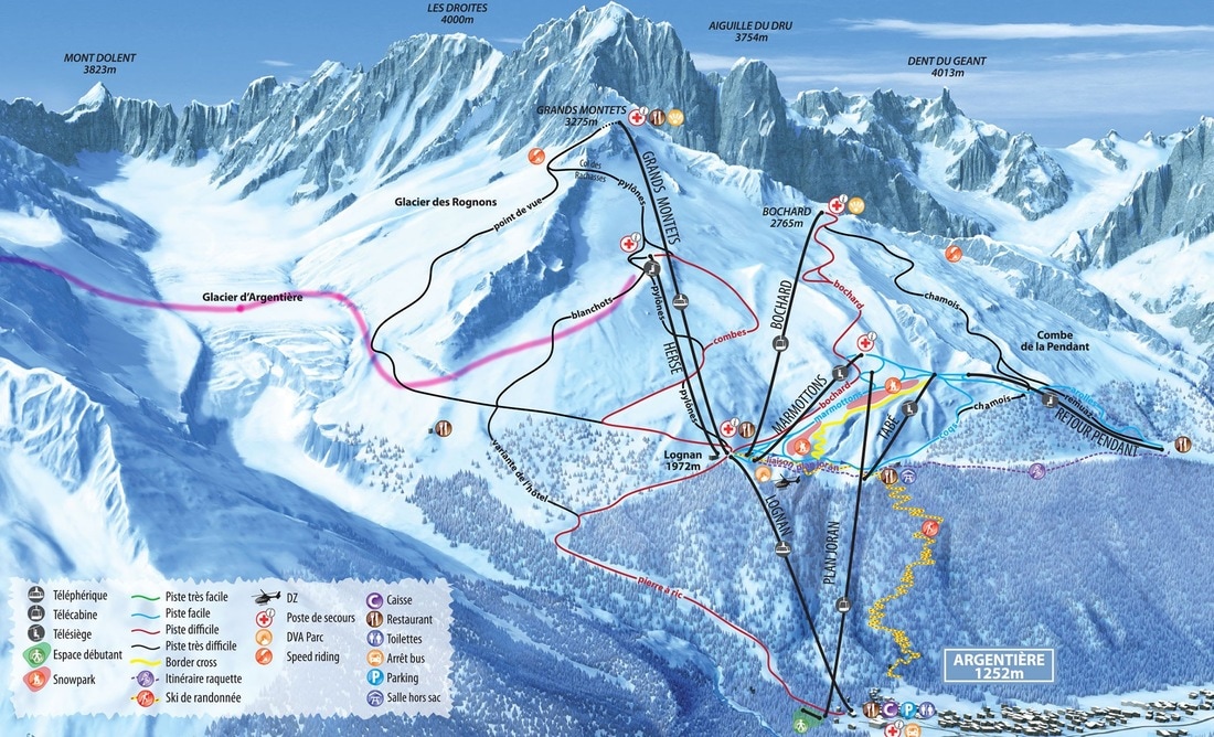
Chamonix to Zermatt
Haute Route Day 1 – Skiing Argentière to Refuge Albert Premier
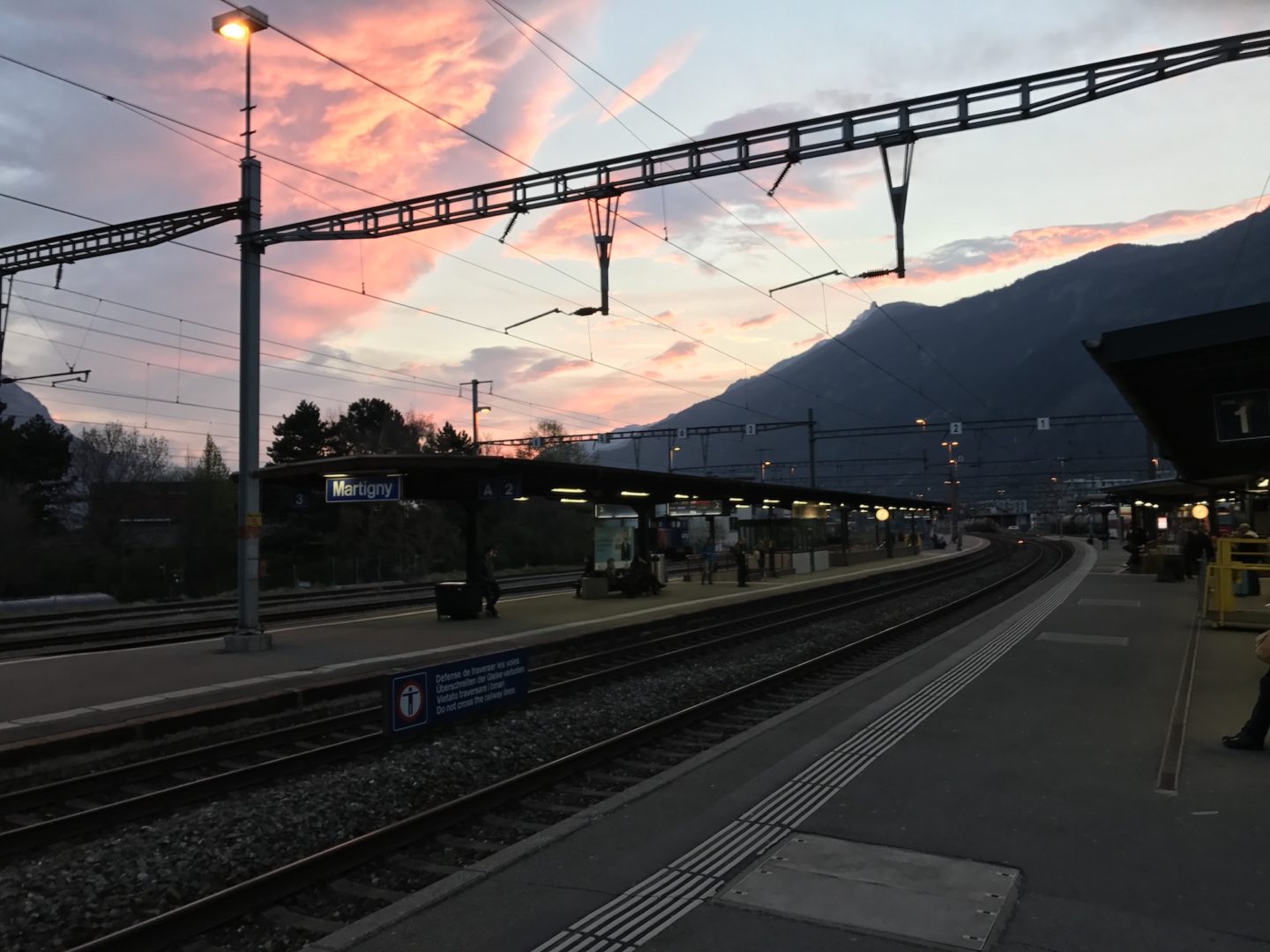
Our Haute Route trip begins with us all meeting in Martigny. From here we take the train to Argentière, then take the lifts up and Ski/Hike to Refuge Albert Premier. Originally we were to go to the Refuge Argentière, but it was completely booked. I think most people were there since Albert Premier was not so crowded.
Climbing stats – 6 miles (9.6 km), 5 hrs 49 minutes, 2810 ft (856 M) ascent, 2396 ft (730 M) descent
Our guides inspected our gear at 7am, and off we went on the 7:45 am train to Argentierre. Our Haute Route trip has begun!


The train ride up the Gorge du Trient was very cool, and time went by very quickly. From there, the walk from the train station to the telecabin station for the Grand Montets was our warm-up for this – our first day of the Haute Route.
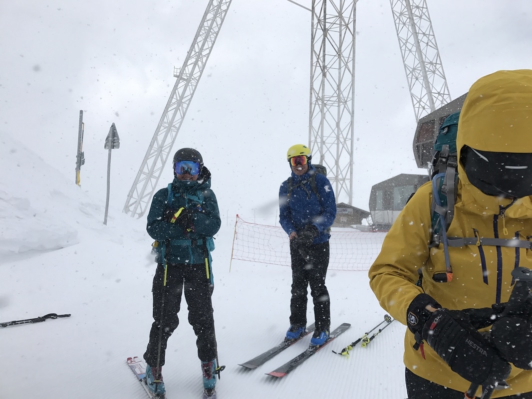
Originally we had planned to take the Lognan Telecabin, followed by the Grand Montets with a nice ski down across the Argentièrre Glacier to our first big climb of the Col de Passon. Unfortunately, the wind gods were not with us. It was snowing and blowing like crazy. The Grands Montets telecabin was closed (and it has since actually burned down). Instead, we had to take the HERSE chair lift which added to our hike for this first day, so instead of skiing down to our first big climb – we climbed to it!
Upon arriving at the top of the HERSE chairlift, we’re ready to take a small downhill run on some icy pistes and begin our first ascent of the well known Col du Passon. Our goal for the day is to make our way to the Refuge Albert Premier. The original plan was to stay at Refuge Argentière, but it was booked a month ahead of time, so our plan shifted to the Refuge Albert Premier.


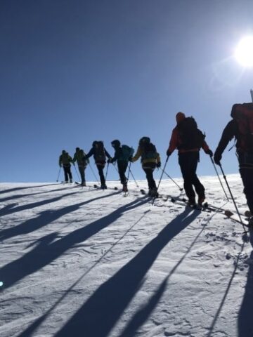
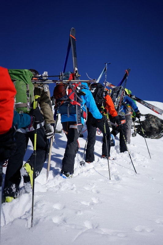
The red arrows show the top and bottom of the Col du Passon as we make our approach. If you look closely you will see small groups of people climbing up! It was steeeeep.


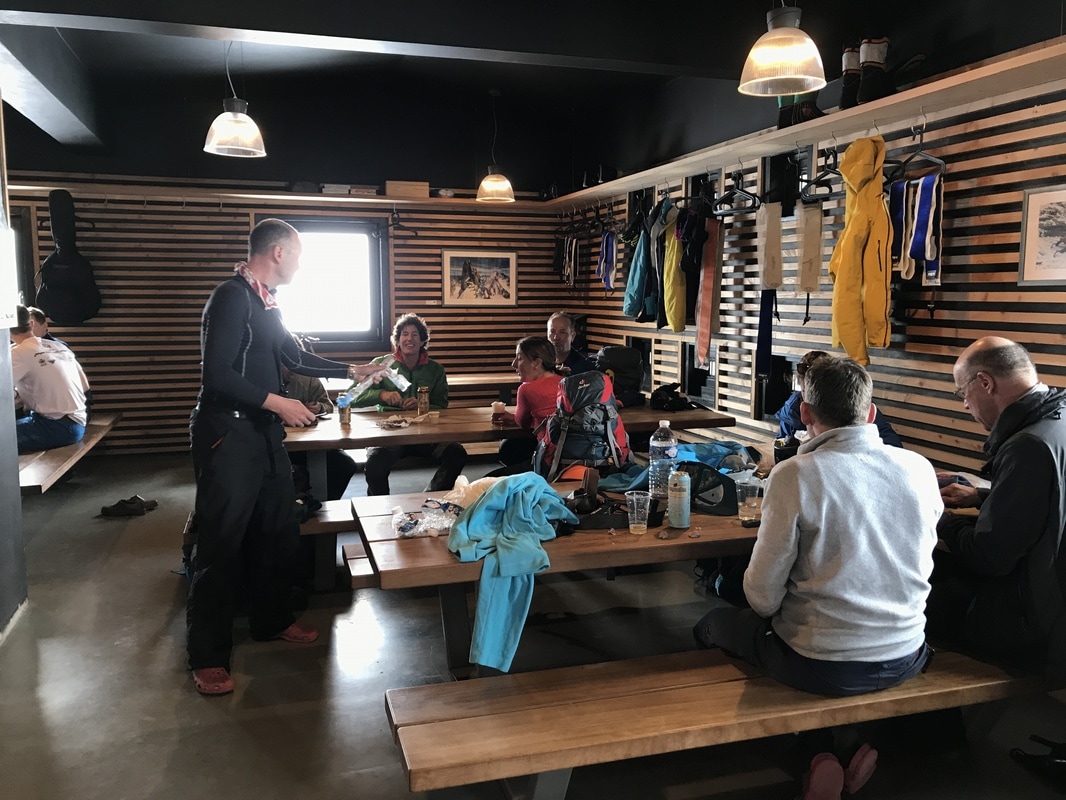
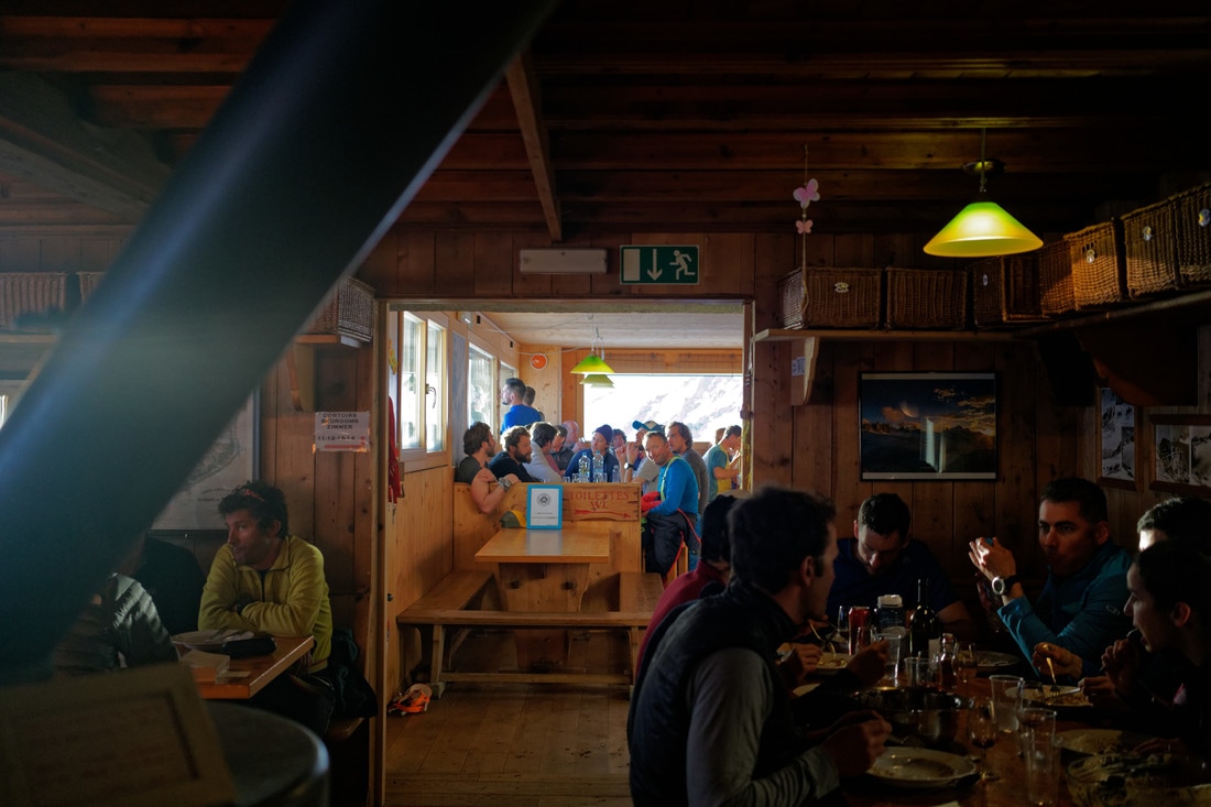
Inside Albert Premier, it is comfortable and not very crowded, as most start with Refuge Argentiere instead. Dinner is good, and thanks to Eric for carrying up the delicious dessert wine – a 2011 Grains de Malice seen on the table.


Haute Route Day 2 – Refuge Albert Premier to Cabane du Trient
First Breakfast in a hut – and early start off to Trient.
Climbing stats – 4.75 miles (7.6 km), 5 hrs 38 min, 2437 ft (715 M) ascent, 907 ft (277 M) descent
On our second day of the Haute Route we covered the ski trek from Refuge Albert Premier to the Cabane du Trient. This took us through the Col du Midi, with some scary high winds. Most would do the Col Superieure du Tour, but the guides thought this track would be better with the high winds.


It was around this point that the guides noticed that Phil’s nose wasn’t his normal nose and that he was developing some signs of frostbite. Phil was “mister covered face” for the rest of the day!
er covered face” for the rest of the day!


Inside the Cabane du Trient where we enjoy dinner and take in the awesome views of the beautiful sunset before turning in for the night. A great way to end day two of the Haute Route!


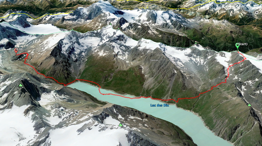
Haute Route Day 3 – Cabane du Trient to Cabane des Dix – multiple stages
Well, this is a crazy day. Originally we were supposed to go from Cabane du Trient to Cabane du Mont Fort. However, the guides realized the trip the day after – from Cabane du Mont Fort to Cabane des Dix – would be too much for our group. Two itineraries were proposed:
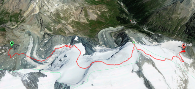
Option 1) Ski down to Champex, and take bus to Arolla, stay in hotel, and ascend to Cabane des Dix the next day.
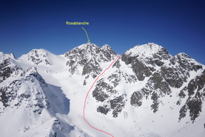
Option 2) Skin up about a mile on day 3 to a helicopter approved landing area, then Heli over to Rosablanche and continue on to Cabane des Dix by ski that day.
Option 2 was only about 120 Fr more per person than Option 1, so all of us went with the Heli option.
Climbing stats – part 1 to the Heli landing spot – 1.3 miles (2 km), 1 hrs 15 minutes, 706 ft (215 M) ascent, 361 ft (110 M) descent
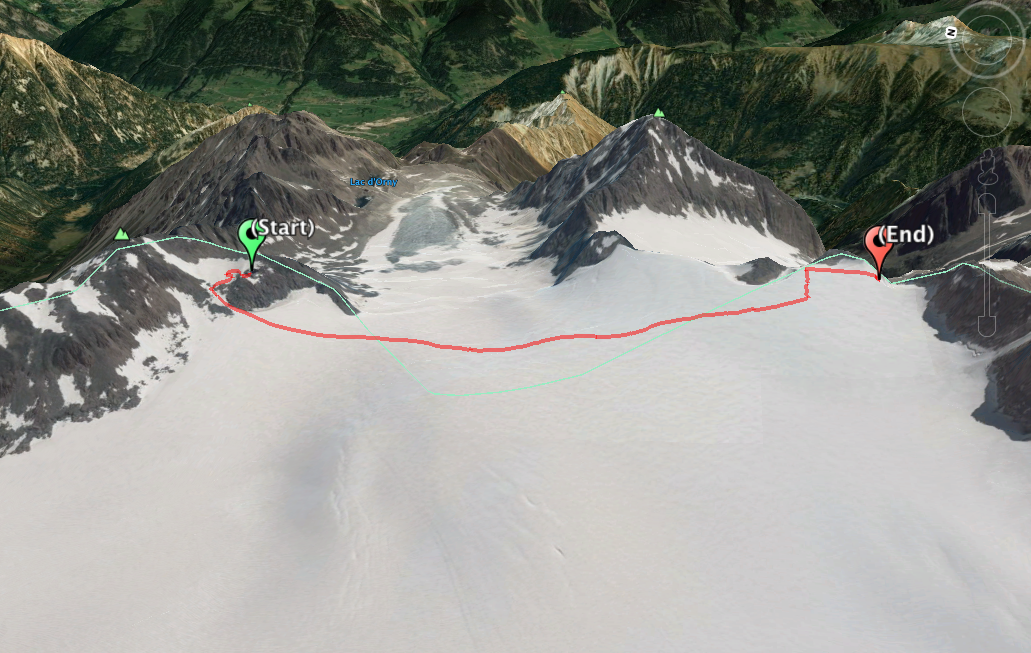


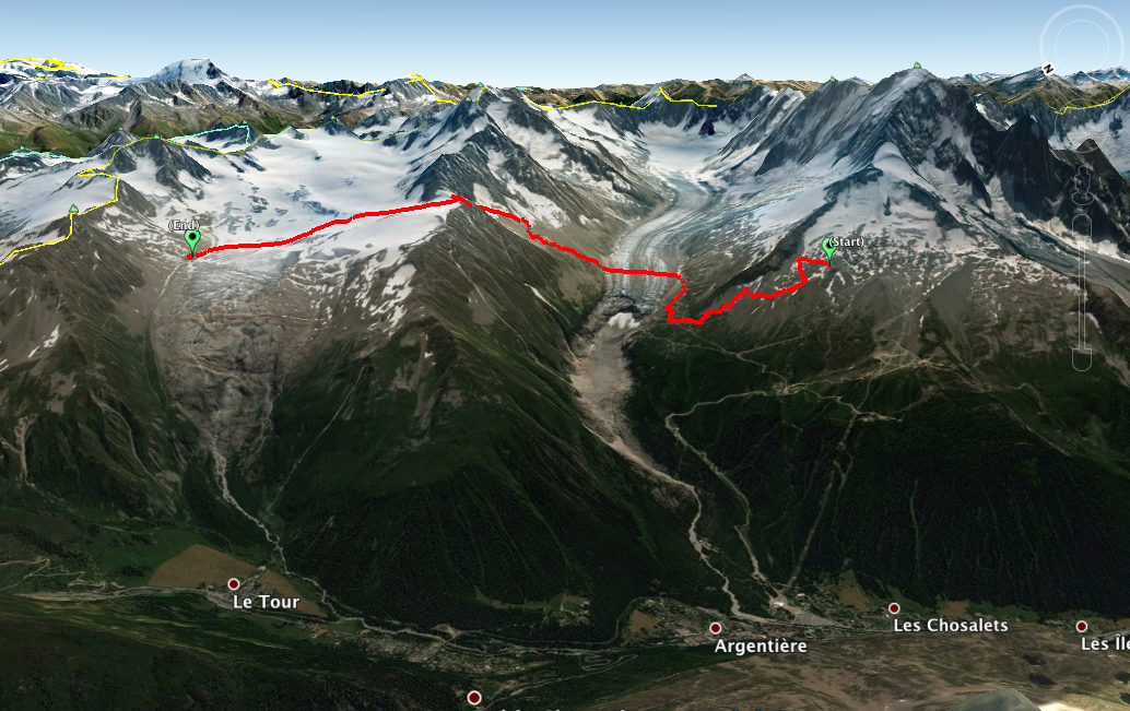
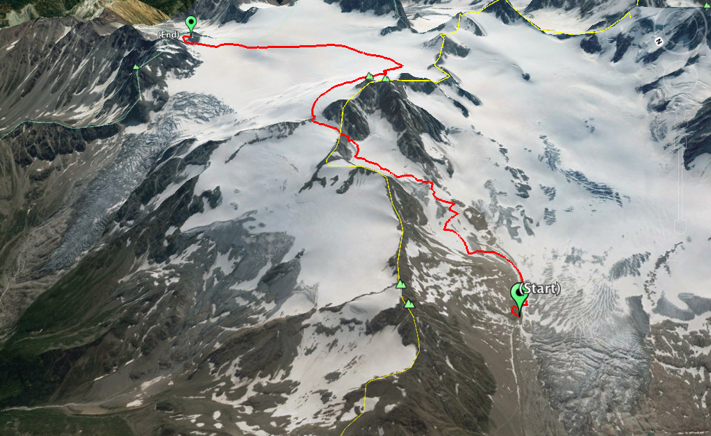
Now it’s time to Climb the Rosablanche to the top, climb down, and trek over to the Cabane des Dix. The below image illustrates the next phase.
Climbing stats – part 3 to the Rosa Blanche to Cabane des Dix – 7.8 miles (12.6 km), 7 hours, elev gain 2631 ft (802 M), elev loss 3937 ft (1200 M)


After skiing the great snow off of the Rosablanche, our descent down to the Lac des Dix began with a run down the Couloir de la Rosablanche. This couloir is well known to the ski racers of the Patrouille des Glaciers – the race between Zermatt and Verbier. For an image of what this Couloir looks like filled with racers going up, click here!


Haute Route Day 4 – Rest Day at the Cabane des Dix
After a long Day 3, we decided to make Day 4 a rest day. Great day to explore the hut a little more! Martin, our guide, explained that too often groups get into their huts at night, eat, go to bed, and never really get to know the character of their hut – this extra day at Cabane des Dix was awesome!!
Some of our group stayed in the hut and relaxed for the day. A few of us skinned up to La Luette to hit a local peak. For those of us that skinned up to La Luette, we were granted with what Martin called “Mouse knee-deep powder” at the beginning, but real powder at the top!
Climbing stats – 3.75 miles (6km) , 3 hrs 55 minutes, 2000 ft (610 M) ascent, 2000 ft (610 M)descent


Tip: Skip carrying a picnic lunch and go for the Rösti option in the Cabane, it is the way to go! Plus, none of the other huts could come close to the Cabane des Dix with regards to Beer selection – they must have had 10-15 choices, while others had 2.
Haute Route Day 5 – Skiing Cabane des Dix to Cabane des Vignettes
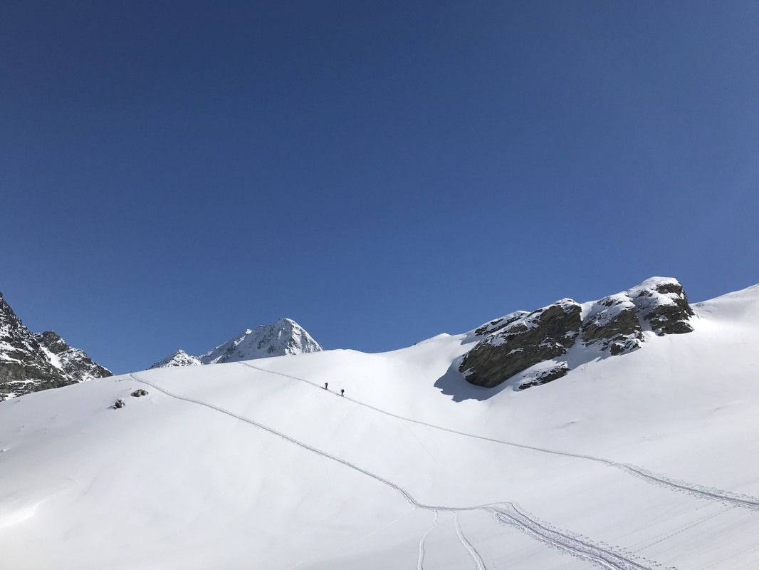
Day 5 starts early. Up at 4:30 am, we leave at 5:30 for the ascent on the Pigne D’Arolla. We had some illness in the group the day before (altitude sickness and perhaps some Asthma), and were worried about a possible need for evacuation. But, thankfully, we pulled it all together and we were ready to go for this big day! It was “headlamps on” and snowing when we started, and we were definitely the first group up and out the door!
Climbing stats – 6.33 miles (10.2 km) , 11 hrs 56 minutes, 3080 ft (939 M) ascent, 2271 ft (692 M) descent


Side Story: What can happen on the Haute Route
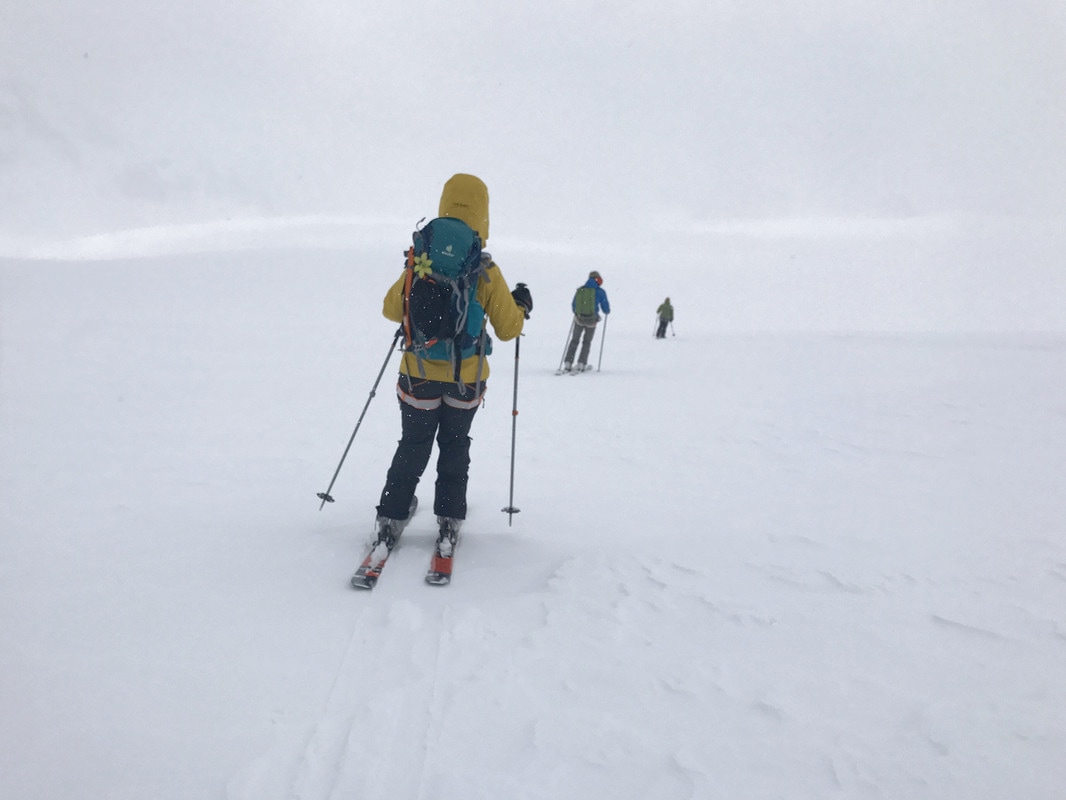
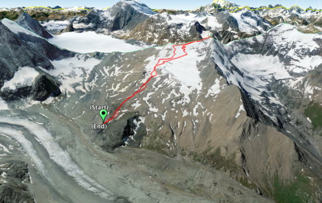
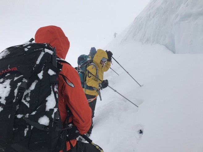
There is a little side story that happened just around the time the picture above was taken. Visibility was horrible, you couldn’t see landmarks, etc…. Our guides stopped, checked their topo maps, altimeter and compass. I offered them a peek at my GAIA app that had topo and a GPS location on it, but they said “no, we’re ok.”
Another guide from Chamonix, leading another group who had been here the week before, passed us and veered to the right. I’m sure there might have been some second-guessing from our guides, but they were confident and we continued on.
We were the first group to hit the Serpentine. Who do you think pulled up behind us about 40 minutes after we last saw them? The group from Chamonix! Our guides were very modest about this, saying it could happen to anyone. But we couldn’t help but snicker at how the Tortoise (definitely our group), beat the hare – at least to the Serpentine!
Interested in other Backcountry Ski Tour options? Check out this guide that outlines all the different ways you can experience Backcountry Skiing.


Haute Route Day 6 – Cabane des Vignettes to Schönbielhütte
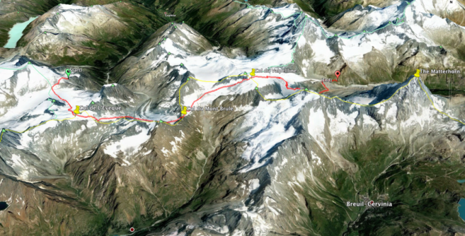
Day 6 started with a departure at 6:30 am. This was one of the longest days for all of us with 3 Col’s to climb – the Col de L’Eveque, the very steep Col du Mont Brulé, and the mentally draining Col du Valpelline. The ski run down beside the Matterhorn was amazing, but the final ascent up the Moraine (https://en.wikipedia.org/wiki/Moraine) to the hut was gruelling. There were times when rocks slid down the hill towards us. The joke of the day was that it was the Chamois pushing the rocks down on us.
The departure from the Cabane des Vignettes was not exactly pleasant as everyone in the hut was leaving at the same time. It was probably 120 people, and the sketchy icy path out of the hut potentially leading to a 500m fall off a cliff! Most people on this trek would go all the way to Zermatt (which I had done back in ’85), but we chose an alternate route including a stopover at an uncrowded Cabane Schöbielhütte. This is a super cool hut right next to the Matterhorn. That way we could then arrive early in Zermatt on our last day with no rushing necessary.
Climbing stats – 13.66 miles (22 km) , 11 hrs 14 minutes, 4196 ft (1279 M) ascent, 5696 ft (1736 M) descent


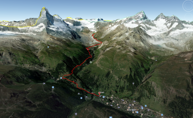
Haute Route Day 7 – Schönbielhütte to Zermatt
Day 7 is our easy day – a cruisy, relaxing run all the way down to Zermatt.
Climbing stats – 7.23 miles (11.6 km), 1 hrs 58 minutes, 6 ft (2 M) ascent, 3477 ft (1060 M) descent


Does the Haute Route sound awesome to you? Looking to get started with Backcountry Skiing? Check out our Backcountry Skiing Know Before You Go blog.