
Canmore is a stunning destination. With towering mountains and sparkling lakes, there’s so much natural beauty. To see as many of these gorgeous natural sights as possible, we highly recommend tackling a few of the best Canmore hikes.
Whether you’re new to hiking or you’ve been doing it for years, these hikes in Canmore, Alberta, Canada offer something for everyone!
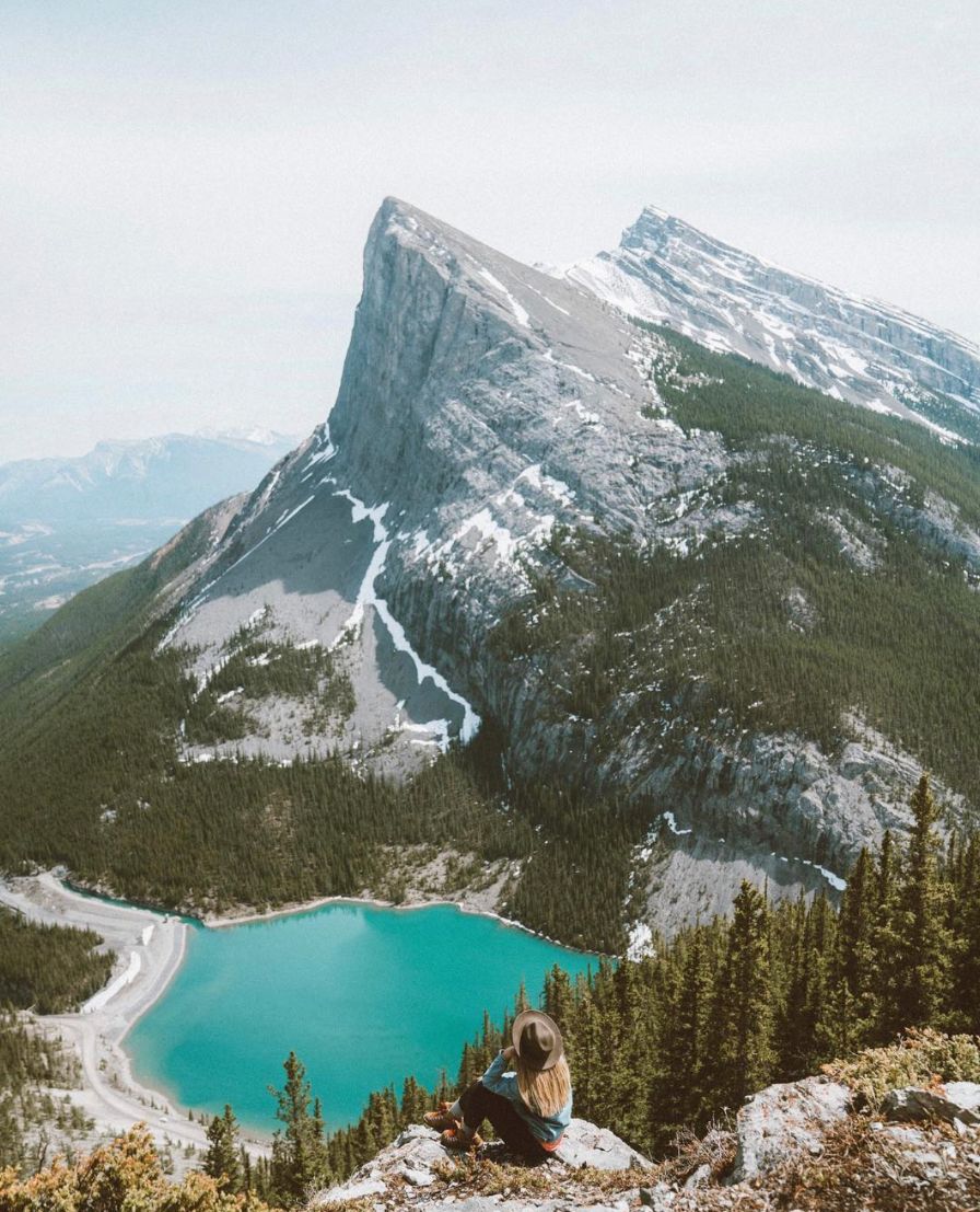
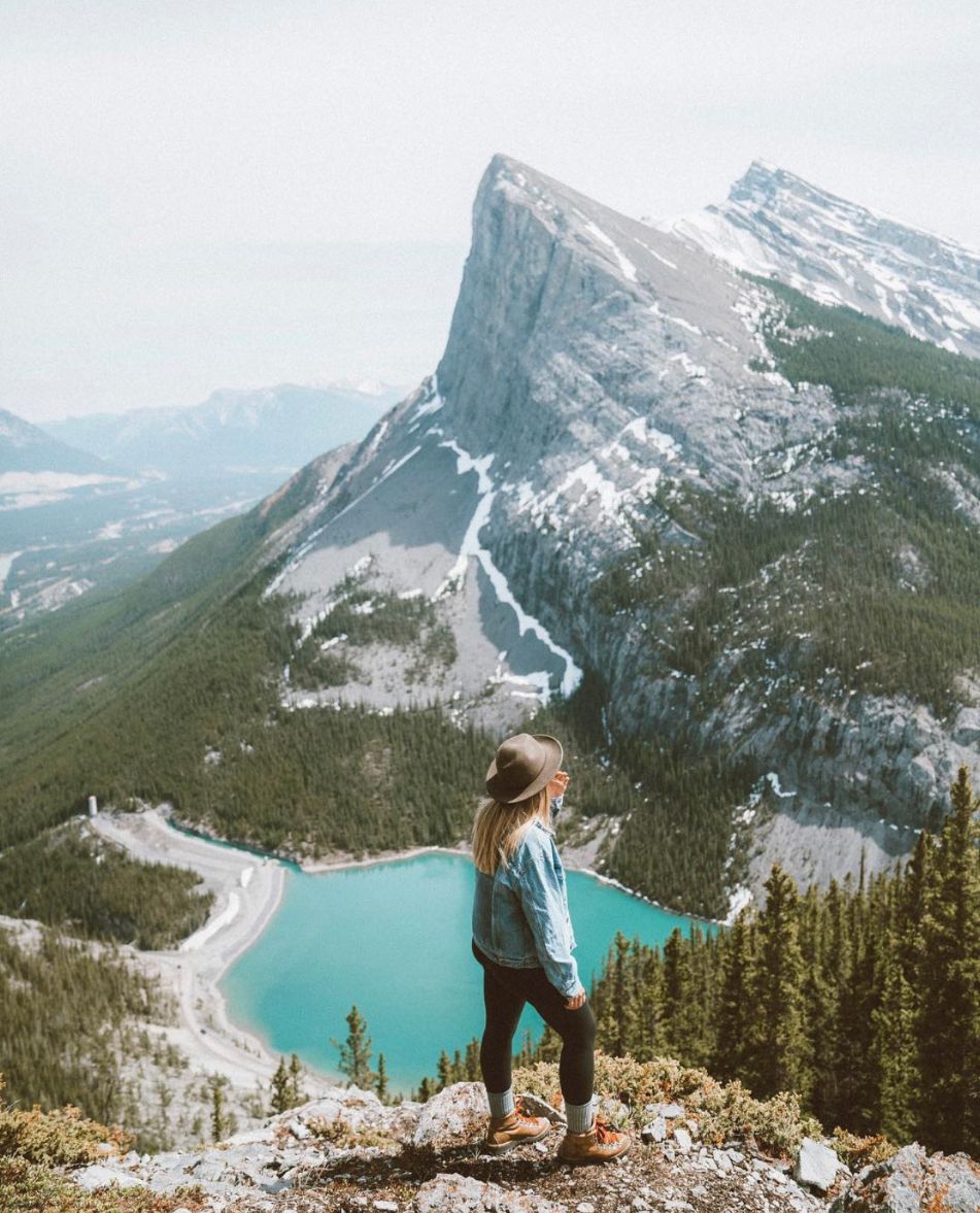
Grassi Lakes
The Grassi Lakes are two of the most beautiful things to see in Canmore. Each of these lakes is a completely different – yet still stunning – color, due to the fact that one is much deeper than the other. You’ll inevitably end up taking dozens of pictures of these lakes.
There are a couple of different ways to start this Grassi Lakes loop trail. Most people recommend heading to the right and going counterclockwise, as this is the slightly easier trail. But if you want to get a bit more of a workout, you can head to the left and go clockwise instead.
*Pro Tip: If you want to take a shortcut, start at Whitemans Pond and hike the Riders of Rohan trail instead. At the 0.7 km mark, you can make a left turn and find yourself at the Grassi Lakes just 0.3 km after that!
Elevation gain: 233 m (764 ft)
Distance (same for one-way and roundtrip, since it is a loop trail): 4.3 km (2.7 mi)
Estimated time: 1.5 hours
Getting there:
Getting to this hike is very easy. Just plug “Grassi Lakes Trail Head” into any GPS, and it should take you there!
Policeman’s Creek Boardwalk
Despite the fact that Policeman’s Creek Boardwalk is one of the easiest hikes in the area, it is still one of the best Canmore hikes. The lovely wooden path winds its way along the calming Policeman’s Creek. Along the way, you can see snow-capped mountain peaks, blooming wildflowers, friendly birds, and so much more!
Elevation gain: None
One-way distance: 2 km (1.3 mi)
Roundtrip distance: 4 km (2.6 mi)
Estimated time: 45 minutes
Getting there:
Like the Grassi Lakes trail, it’s quite easy to get to the Policeman’s Creek Boardwalk. Just use a GPS to take you to “Policeman’s Creek Trail,” and you should be good to go!
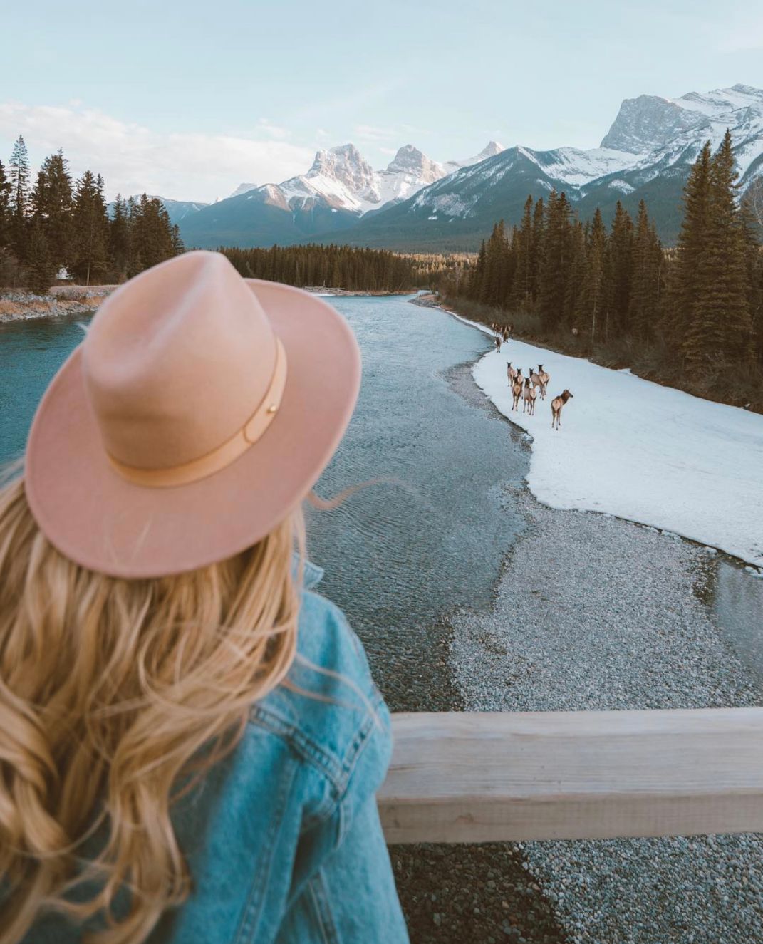
Three Sisters
No list of the best Canmore hikes would be complete without the Three Sisters. The Three Sisters are a trio of gorgeous mountain peaks in the Rocky Mountains. As a matter of fact, these three mountains are individually known as the Big Sister, the Middle Sister, and the Little Sister.
There are actually a few different ways to hike to the Three Sisters. You can choose between the Three Sisters Creek, the Three Sisters Pass, and the Highline Trail and Three Sisters Pathway Loop. Our favorite is the last option, as it’s the perfect blend of effort and reward. Along the way, you’ll see thriving bird life, the flowing Bow River, and of course, the Three Sisters.
Elevation gain: 471 m (1,545 ft)
Distance (same for one-way and roundtrip, since it is a loop trail): 9.8 km (6.1 mi)
Estimated time: 2 to 3 hours
Getting there:
Just plug “Three Sisters Pathway” into your GPS! It’s as simple as that.
East End of Rundle
So far on this list of the best Canmore hikes, we’ve kept things pretty tame. But given that Canmore is in the Rocky Mountains, it should come as no surprise that there are some difficult hikes as well. East End of Rundle, more commonly referred to as just EEOR or “Eeyore,” is a fantastic example.
With an 872-metre elevation gain, the East End of Rundle is not for the faint of heart. After the first thirty minutes of hiking in a forest, the path then transitions to a ridge trail with steep drop offs. In other words, you’ll definitely want to bring some proper hiking gear on this adventure.
That said, for those who can hike and scramble their way to the end, it’s completely worth the effort. Once you reach the peak, you’ll be rewarded with breathtaking views of Canmore, Ha Ling Peak, and Bow Valley. It’s absolutely magical!
Elevation gain: 872 m (2,860 ft)
One-way distance: 2.8 km (1.7 mi)
Roundtrip distance: 5.6 km (3.5 mi)
Estimated time: 4 to 6 hours
Getting there:
Just tell your GPS to take you to the “East End of Rundle Trailhead,” and you’ll be set!
Ha Ling Peak
Just down the road from EEOR is Ha Ling Peak. Like its neighbor, the Ha Ling Peak trail is quite difficult, but worth the amount of effort. Yet Ha Ling Peak does have a leg up on EEOR. In 2019, Alberta Parks did a major overhaul of the trail, adding in steps and handrails. These new additions have made the hike to the top a little bit easier.
Once you reach the peak, you’ll be able to see for kilometres! Take in beautiful views of EEOR, Canmore, Calgary, and so much more.
It is important to note that Ha Ling Peak is one of the most popular Canmore hikes. If you want to avoid the crowds, try to hike on a weekday or very early in the morning.
Elevation gain: 748 m (2,454 ft)
One-way distance: 3.6 km (2.2 mi)
Roundtrip distance: 7.2 km (4.5 mi)
Estimated time: 4 hours
Getting there:
When you plug in “Ha Ling Peak Trailhead,” your GPS should take you to the start of the path, which is on Alberta 742.
Tent Ridge Horseshoe
Tent Ridge Horseshoe is undoubtedly one of the best Canmore hikes. While the beginning scramble is difficult, it’s all worth it once you reach the ridge. You’ll constantly get to gape in awe of stunning views of mountain peaks and the Canmore area.
Since Tent Ridge Horseshoe is a loop trail, you can hike it either clockwise or counterclockwise. For an easier hiking experience, we recommend going clockwise.
Elevation gain: 750 m (2,460 ft)
Distance (same for one-way and roundtrip, since it is a loop trail): 10.6 km (6.6 mi)
Estimated time: 4 to 6 hours
Getting there:
All you need to do to get to this amazing Canmore hike is type “Tent Ridge Horseshoe Trail Head” into your GPS. Then, you can make the one-hour drive from the heart of Canmore.
Smutwood Peak
Calling all hiking experts! Smutwood Peak is one of the best hikes in Canmore for you! If you’re not an avid hiker, Smutwood Peak is likely a trail that you’ll have to work your way up to. With a lengthy distance, challenging weather, narrow trails, and even a bit of rock climbing, this hike certainly isn’t for beginners.
If you’ve done a lot of advanced hiking in your life, you won’t regret tackling Smutwood Peak. This trail boasts beautiful views of mountains, lakes, rivers, and even the occasional waterfall. There’s never a dull moment on this incredible Canmore hike.
Elevation gain: 961 m (3,152 ft)
One-way distance: 10 km (6.2 mi)
Roundtrip distance: 20 km (12.4 mi)
Estimated time: 7 to 8 hours
Getting there:
The start of the hike to Smutwood Peak is actually just around the corner from the Tent Ridge Horseshoe trailhead. Just plug “Smutwood Peak Trailhead” into your GPS, and you’ll be good to go!
Mount Lady MacDonald
If you’re a serious hiker and want a challenge, Mount Lady MacDonald is one of the best hikes for you! As a matter of fact, some say that hiking to the top of this mountain is harder than tackling EEOR or Ha Ling Peak.
The first chunk of this hike is to what was originally supposed to be a teahouse. Unfortunately, this teahouse – which would’ve had some breathtaking mountain views, by the way – never came to be. Instead, this area was recently turned into a helipad.
Most hikers opt to stop at the helipad and turn around. After all, it’s already quite a difficult climb to get there. But the most advanced and determined hikers make their way all the way to the peak. If that sounds like you, go for it! But if it gets to be too much, know your limits and try again another time.
If you do make your way all the way to the top, you’ll be rewarded with stunning views of dozens of mountain peaks. As a matter of fact, on the clearest day, you can see up to 40 kilometres away!
Elevation gain: 1,304 m (4,280 ft)
One-way distance: 4.9 km (3 mi)
Roundtrip distance: 9.8 km (6.1 mi)
Estimated time: 6 to 8 hours
Getting there:
The start of the trail to Mount Lady MacDonald actually starts right in the heart of Canmore! It actually starts right behind A Bear & Bison Canadian Country Inn. For more exact directions, type “Mount Lady MacDonald Trailhead” into your GPS.
Well there you have it! A list of the best Canmore hikes! Are there any other hikes in Canmore that you think should have made it onto this list? Let us know in the comments!
Need to fuel up after your adventure? Check out our guides to the best Canmore Coffee Shops, Breakfast in Canmore, and Best Restaurants in Canmore!
binance register
Tuesday 23rd of May 2023
Thanks for shening. I read many of your blog posts, cool, your blog is very good. https://accounts.binance.com/en/register-person?ref=P9L9FQKY